


Toqua Twp. Voting District, Big Stone County, Minnesota
About
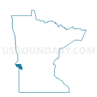
Outline

Summary
| Unique Area Identifier | 601223 |
| Name | Toqua Twp. Voting District |
| County | Big Stone County |
| State | Minnesota |
| Area (square miles) | 35.06 |
| Land Area (square miles) | 34.05 |
| Water Area (square miles) | 1.00 |
| % of Land Area | 97.14 |
| % of Water Area | 2.86 |
| Latitude of the Internal Point | 45.53667350 |
| Longtitude of the Internal Point | -96.56479620 |
Maps


Graphs
Select a template below for downloading or customizing gragh for Toqua Twp. Voting District, Big Stone County, Minnesota


Neighbors
Neighoring Voting District (by Name) Neighboring Voting District on the Map
- Almond Twp. Voting District, Big Stone County, MN
- Barry Voting District, Big Stone County, MN
- Browns Valley Twp. Voting District, Big Stone County, MN
- Foster Twp. Voting District, Big Stone County, MN
- Graceville Twp. Voting District, Big Stone County, MN
- Parnell Twp. Voting District, Traverse County, MN
- Prior Twp. Voting District, Big Stone County, MN
- Tara Twp. Voting District, Traverse County, MN
Top 10 Neighboring County Subdivision (by Population) Neighboring County Subdivision on the Map
- Browns Valley township, Big Stone County, MN (358)
- Prior township, Big Stone County, MN (247)
- Graceville township, Big Stone County, MN (197)
- Foster township, Big Stone County, MN (112)
- Almond township, Big Stone County, MN (110)
- Tara township, Traverse County, MN (92)
- Parnell township, Traverse County, MN (60)
- Toqua township, Big Stone County, MN (53)
- Barry city, Big Stone County, MN (16)